james rennell - father of cartography in india
.jpg&w=3840&q=75)
James Rennell - Father of Indian Cartography & Geography
James Rennell (1742–1830) is widely recognized as the father of Indian cartography and geography for his pioneering role in mapping the Indian subcontinent with unprecedented accuracy during the late 18th century.
Early Life and Career
Born in England in 1742, James Rennell joined the British East India Company at an early age. His career began as a marine officer, but he soon developed a deep interest in geography and cartography. Rennell's practical experience navigating the seas, combined with his scientific curiosity, positioned him as a natural pioneer in geographic exploration.
By the 1770s, Rennell was stationed in India, where the British Empire was rapidly expanding. He recognized that accurate and detailed maps of the region were essential for administration, military strategy, and economic planning.
Surveyor General of Bengal
In 1767, James Rennell was appointed the first Surveyor General of Bengal. Over the next decade, he conducted the most comprehensive and detailed survey of Bengal and much of India that had ever been attempted. His work involved combining on-the-ground measurements, indigenous maps, and classical data sources to create detailed geographical maps crucial for British administration, military strategy, and commerce.
Pioneering Cartographic Work in India
Prior to James Rennell’s efforts, maps of India were often incomplete, inaccurate, or based on second-hand reports. Rennell approached the challenge with systematic surveys and empirical methods. He undertook extensive fieldwork across various regions of India, combining direct observation with careful measurements of rivers, mountain ranges and settlements.
One of his most significant achievements was the mapping of the Ganges River Basin, one of the most complex river systems in the world. His accurate delineation of the river’s course and its tributaries provided invaluable knowledge for British administrators and engineers.
James Rennell also compiled information on political boundaries, local economies, topography and cultural landmarks. His ability to synthesize geographic data with historical and ethnographic information made his work highly influential.
Major Contributions and Achievements
First Systematic Mapping of India: Rennell is credited with creating the first detailed and scientific map of India, known as the "Rennell Map of Hindustan" (1783). This map became the most authoritative reference for decades and was widely used by colonial officials, explorers, and scholars.
Survey of Bengal: One of Rennell’s early major projects was the Survey of Bengal, where he meticulously charted the region’s terrain, waterways, and settlements. His maps of Bengal were revolutionary for their time in terms of accuracy and detail.
Published Works: Rennell authored several important works, including “A Historical Map of India” (1783) and “Memoir of a Map of Hindustan” (1788), which combined geographical data with historical narratives. His publications became reference points for geographers and historians alike.
Challenges and Methodology
James Rennell’s surveys were carried out under difficult and sometimes dangerous conditions: traversing remote wilderness, hostile territories, and navigating unreliable equipment. Despite limited resources, Rennell applied scientific rigor to cartography. He measured distances, used triangulation, and incorporated a "graticule" or grid system to increase map accuracy—techniques that set new standards in survey cartography.
Later Years and Legacy
After returning to England in 1782, James Rennell continued to write and refine his works on India and other geographic subjects. He gained international acclaim, published studies on Western Asia and oceanography, and advised exploratory missions such as Mungo Park’s African expeditions. Rennell’s contributions earned him the Copley Medal from the Royal Society in 1791 and established him as a foundational figure in geographic science.
Why Is James Called the Father of Cartography in India
Before Rennell, India’s geography was poorly documented in Western knowledge, often based on incomplete or inaccurate maps. By systematizing measurement, integrating local knowledge, and producing detailed, scientifically-grounded maps, Rennell raised the field of Indian cartography to a new level. His work laid the groundwork for subsequent large-scale projects like the Great Trigonometrical Survey of India beginning in 1802.
As we delve deeper into the realm of cartography, it's essential to recognize the contributions of other prominent figures who have shaped the field in India. Below is a list of some of the most famous cartographers in India who have made significant impacts on the art and science of mapping in the region.
Famous Cartographers of India
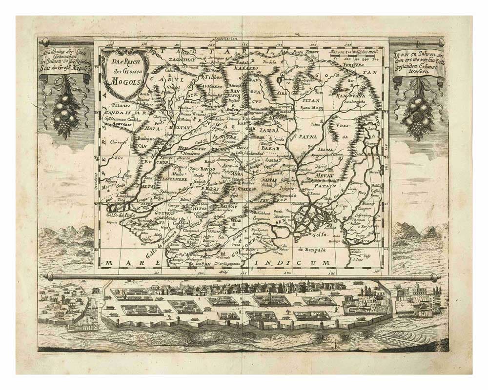 1. William Lambton (1753–1823)
Initiated the Great Trigonometrical Survey of India in 1802, which aimed to measure and map the entire Indian subcontinent with high precision.
2. George Everest (1790–1866)
Surveyor General of India (1830–1843), he significantly advanced the Great Trigonometrical Survey. Mount Everest was named in his honor.
3. Johann Christoph Wagner (1707–1770)
A German cartographer and engineer who served in India, Wagner produced important early maps and surveys of parts of India, contributing to European knowledge of Indian geography.
4. Alexander Cunningham (1814–1893)
Primarily known as an archaeologist, Cunningham also contributed to mapping ancient sites and regions of India, combining cartographic precision with historical analysis.
5. Henry Walter Bellew (1834–1892)
A British medical officer and cartographer who created important ethnographic and geographic maps of India and neighboring regions like Afghanistan.
6. Nain Singh Rawat (1830–1901)
An Indian explorer and surveyor who mapped Tibet and the Himalayas as part of the Great Trigonometrical Survey, often under extremely harsh and dangerous conditions.
7. Radhanath Sikdar (1813–1870)
An Indian mathematician and surveyor who contributed significantly to calculating the precise height of Mount Everest during the Great Trigonometrical Survey.
Conclusion
James Rennell’s meticulous mapping and surveying of India revolutionized geographic knowledge of the region, supporting British colonial administration and influencing global cartographic practice. His surveys and atlases remain landmarks in the history of cartography, securing his enduring title as the father of Indian cartography.
Image Credit:
“A map of Southwestern Asia. 1 - 17 000 000 - By J. Rennell”, Rennell, James, via Wikimedia Commons
– Public Domain.